Category:California State Route 90
Jump to navigation
Jump to search
highway in California   | |||||
| Upload media | |||||
| Instance of | |||||
|---|---|---|---|---|---|
| Location |
| ||||
| Transport network |
| ||||
| Owned by | |||||
| Maintained by | |||||
| Inception |
| ||||
| Length |
| ||||
| |||||
Subcategories
This category has the following 4 subcategories, out of 4 total.
Pages in category "California State Route 90"
This category contains only the following page.
Media in category "California State Route 90"
The following 39 files are in this category, out of 39 total.
-
 CA 100 Right of Way and Adopion map.pdf 14,466 × 9,233; 1.43 MB
-
 CA 101 Right of Way and Adopion map.pdf 14,366 × 9,100; 1.54 MB
-
 CA 102 Right of Way and Adopion map.pdf 14,466 × 9,133; 598 KB
-
 CA 103 Right of Way and Adopion map.pdf 15,000 × 9,066; 516 KB
-
 CA 104 Right of Way and Adopion map.pdf 1,650 × 1,275; 1.78 MB
-
 CA 105 Right of Way and Adopion map.pdf 14,600 × 8,933; 1.63 MB
-
 CA 106 Right of Way and Adopion map.pdf 14,700 × 9,200; 1.61 MB
-
 CA 107 Right of Way and Adopion map.pdf 14,733 × 9,200; 1.41 MB
-
 CA 108 Right of Way and Adopion map.pdf 14,700 × 9,233; 1.03 MB
-
 CA 109 Right of Way and Adopion map.pdf 14,800 × 9,266; 1.27 MB
-
 CA 110 Right of Way and Adopion map.pdf 14,566 × 9,333; 1.24 MB
-
 CA 111 Right of Way and Adopion map.pdf 14,500 × 8,933; 1.09 MB
-
 CA 112 Right of Way and Adopion map.pdf 14,433 × 9,133; 1.13 MB
-
 CA 113 Right of Way and Adopion map.pdf 14,600 × 9,266; 1.04 MB
-
 CA 114 Right of Way and Adopion map.pdf 14,700 × 8,366; 1.09 MB
-
 CA 115 Right of Way and Adopion map.pdf 14,833 × 9,366; 1.33 MB
-
 CA 116 Right of Way and Adopion map.pdf 14,866 × 9,266; 1.18 MB
-
 CA 117 Right of Way and Adopion map.pdf 14,833 × 9,300; 1.05 MB
-
 CA 118 Right of Way and Adopion map.pdf 14,900 × 9,366; 1.62 MB
-
 CA 119 Right of Way and Adopion map.pdf 14,833 × 9,300; 1.72 MB
-
 CA 120 Right of Way and Adopion map.pdf 14,800 × 9,233; 814 KB
-
 CA 121 Right of Way and Adopion map.pdf 14,866 × 9,333; 2.17 MB
-
 CA 122 Right of Way and Adopion map.pdf 14,633 × 9,433; 1.93 MB
-
 CA 123 Right of Way and Adopion map.pdf 14,633 × 9,133; 689 KB
-
 CA 90 Right of Way and Adopion map.pdf 14,970 × 9,237; 1.15 MB
-
 CA 91 Right of Way and Adopion map.pdf 5,397 × 3,297; 12.51 MB
-
 CA 92 Right of Way and Adopion map.pdf 14,737 × 9,093; 1.59 MB
-
 CA 93 Right of Way and Adopion map.pdf 14,768 × 9,147; 1.04 MB
-
 CA 94 Right of Way and Adopion map.pdf 14,827 × 9,243; 1.15 MB
-
 CA 95 Right of Way and Adopion map.pdf 14,987 × 9,168; 922 KB
-
 CA 96 Right of Way and Adopion map.pdf 14,566 × 9,310; 1.58 MB
-
 CA 97 Right of Way and Adopion map.pdf 14,531 × 9,139; 1.43 MB
-
 CA 98 Right of Way and Adopion map.pdf 14,566 × 9,066; 1.17 MB
-
 CA 99 Right of Way and Adopion map.pdf 14,293 × 9,083; 1.77 MB
-
 California 90.svg 385 × 401; 13 KB
-
 California State Route 90.svg 1,152 × 640; 305 KB
-
 Elevation Sea Level Sign Death Valley 2013.jpg 3,119 × 2,049; 2.55 MB
-
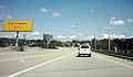 Marina Freeway eastbound.jpg 400 × 232; 36 KB
-
 SR-90 west sign.jpg 720 × 538; 48 KB


Categories:
- State highways in California by number
- Roads in Orange County, California
- Roads in Los Angeles County, California
- Venues of the 1984 Summer Olympics
- Streets in Los Angeles
- Culver City, California
- La Habra, California
- Brea, California
- Fullerton, California
- Yorba Linda
- Streets in Anaheim, California
- Roads numbered 90